If you live in Calabar, you already know the truth, you do not need a VIP ticket to enjoy Carnival. The real “street party” happens on the open parts of the route where bands pass close enough for you to hear the drums, catch the chants, and feel the energy.
The challenge is picking a spot that stays accessible once roads close, still gives you a clear line of sight, and lets you move if the crowd becomes too tight. This guide focuses on places locals use every year, free, public, and practical.
First, understand how the parade route behaves
The main cultural parade follows a long city corridor (often described as roughly 12km) through central Calabar, with popular sections around Millennium Park, Mary Slessor Avenue, Marian Road, MCC, and on toward the stadium axis. Media coverage around recent editions keeps pointing to those same landmarks because that is where the action and the crowd control concentrate. See general route context in BusinessDay’s carnival coverage and route commentary: BusinessDay (Carnival Calabar route and parade energy).
On peak days, the state often restricts vehicle movement and closes sections of the corridor to manage safety and flow. That affects where you can be dropped, where you can park, and which junctions you can cross. Recent examples include public notices and reporting on closures and movement restrictions around Carnival events: CrossRiverWatch (route closures update) and Daily Post (movement restriction as carnival climaxes).
What that means for free viewers
- Arrive early for the “straight line” roads (Mary Slessor and Marian). Once the crowd locks in, you will struggle to squeeze forward without causing trouble.
- Use side streets to approach, then step onto the main corridor. Locals do this to avoid the densest checkpoints and to keep an exit route.
- Pick a meeting point that is easy to describe to a child or a friend with low battery, for example “Watt Market main gate area” or “Eleven-Eleven roundabout by the park fence.”
| Quick decision | Best free choice | Why locals like it |
|---|---|---|
| You want to see the bands early | Millennium Park / Eleven-Eleven roundabout edges | Early movement, less “already-tired” performers, easier to claim a spot if you come before sunrise |
| You are coming with kids | Wider sections near Mary Slessor axis (away from tight junction mouths) | More space to step back, better chance of finding an exit lane |
| You want the loudest atmosphere | Marian Road public sidewalks (not inside paid stands) | That is where crowd density and band interaction peak |
| You need a safer regroup point | Watt Market area landmarks | Easy to describe, familiar to residents, lots of visible junctions |
The best consistently free spots (start to mid-route)
1) Millennium Park and the Eleven-Eleven roundabout corners
If you want a free spot that still feels “official”, start here. The park edges and the roundabout corners give you a broad view and early access before the crowd thickens down the route. Locals who want to film the bands while costumes are still crisp often choose this side.
- Arrive time: 5:30am to 6:30am if you want front-row on the fence line. By 7:30am, you may still get a view, but not a clean one.
- Best angle: stand a little back from the roundabout mouth, not directly at the junction where people keep pushing through.
- Backup move: if it gets too tight, step into the park side and watch from a safer distance, then re-approach when the band passes.
2) Mary Slessor Avenue (choose cross-streets, not the busiest junction mouth)
Mary Slessor is one of the classic free-view corridors. The mistake is standing right at the tightest cross points where pedestrians keep cutting across and security keeps shouting. A better local tactic is to pick a stretch between junctions, then approach from a side street so you can retreat the same way.
- Best for: families, groups, anyone who wants a steadier view without fighting for space every two minutes.
- What you will see: full band blocks, drummers, dancers, and the crowd call-and-response that makes Calabar Carnival famous. For broader context on the parade scale, see: The Guardian (street carnival display and route atmosphere).
3) Watt Market axis (use it as both viewing zone and meeting point)
For locals, Watt Market is more than shopping. On carnival day, it becomes a reference point. If someone gets separated, “Watt” is easier to locate than a random pole on Marian Road.
The viewing here works best when you do two things: pick a spot where security still has an access lane, and keep your group a little behind the front line so you can breathe and move.
- Meeting point idea: agree on one clear place before you arrive, then repeat it to everyone, including the children.
- Safety note: do not block walkways with coolers, chairs, or big mats. Obstructions attract enforcement, and they also cause fights with residents trying to pass.
4) Creek Road / Government House area (for serious early birds)
If you like calm before the storm, some residents aim for the Creek Road side near the Government House area early in the morning. You will not get the wildest crowd here, but you can get a cleaner line of sight if you are there before the rush. Locals who use this option typically arrive around 6:00am to 7:00am and settle in.
5) Marian Road sidewalks (free, loud, and packed)
Marian Road is where many people instinctively go, and that is why it fills up fast. You can still enjoy it for free, but you have to be deliberate.
- Where to stand: choose a point with a wide shoulder and fewer roadside vendors, so you are not trapped between a stall and a crowd surge.
- How to keep your view: do not chase every band. Pick one spot, enjoy the full flow, then move only during a clear break.
- How to approach: come through smaller roads that connect into Marian, instead of trying to force yourself through the thickest crowd line.
Once you have these core spots in mind, the next step is choosing quieter alternatives, elevated angles for photos, and contingency options when weather or last-minute barricades change the plan.
Quieter free spots, better light, and easier exits (mid-route to finish)
6) Marina Resort side and the Calabar riverfront (Moore Road direction)
If you want clean photos without fighting elbows, the riverfront is one of the easiest free options. You get open space, better background, and fewer people standing right in front of your lens. You also hear the band coming, which gives you time to set your phone and pick your angle.
- Best for: photos and video, couples, anyone who hates tight crowd pressure.
- How to make it work: if the obvious entrance area is choked, keep walking along the same riverfront direction for 5 to 10 minutes. The crowd usually thins once you are not right on the landmark.
- Photo tip: stand slightly side-on to the route, not dead front, so you capture both the band and the line behind them.
7) MCC to Murtala Mohammed Highway stretch (pick a wide shoulder, not a junction mouth)
This part of the corridor is where many bands are fully warmed up. You catch better performance, fuller dance blocks, and the moments when crowd and band start responding to each other.
- Best for: people who want continuous action, not just a quick pass.
- Where to stand: look for set-back fences, wide sidewalks, and places you can step back without being pushed into the road.
- What to avoid: tight junctions where people keep crossing and where security keeps forcing gaps.
8) U.J. Esuene Stadium corridor (more structure, clearer lanes)
Even if you are not buying a seat inside, the public approaches around the stadium axis can still give you plenty of parade energy. Security presence tends to be stronger here, and that usually means clearer emergency lanes and fewer random surges.
- Best for: families meeting up, groups arriving from different areas, anyone who wants a more controlled feel.
- Local move: decide your exit direction early. Leaving “against the flow” is what wastes time and raises stress.
9) Tinapa axis and lakeside areas (space, flat ground, stroller friendly)
When Carnival activities swing toward Tinapa, you get more breathing room than central Marian. The paths are flatter, which helps people using wheelchairs, strollers, or just trying to keep kids close.
- Best for: mobility needs, families, people who want calmer viewing.
- Watch out: transport out can bottleneck after the peak, so leave a little early if you do not want to be stuck hunting keke in a crowd.
10) Eight Miles Flyover and similar elevated edges (quick view, then relocate)
Elevated edges can give you that “full parade line” view for free. The trade-off is distance. You will not feel close to the performers, but you will see the full shape of floats and dance blocks passing.
- Use it for: a 10 to 20-minute watch and film, then move back to street level elsewhere.
- Safety: do not climb railings or block foot movement. People still need to pass.
Community-led vantage points (free, but use common sense)
Church compounds, school fronts, and familiar neighbourhood corners
These are the spots Calabar people quietly rely on. Some churches open their frontage after early service, some schools have wide perimeters, and some corners are informally “guarded” by neighbours who just want order.
- Only use places that are clearly open to the public that day.
- If an usher, security, or a resident says no, move on immediately.
- Do not block gates. Do not hang on fences.
How to get a good free spot without stress
Arrival times locals actually use
If you want a clean view at popular points like Creek Road, Government House area, Marian Road, or Millennium Park, you should be there early. Many people in Calabar target 6:00am to 7:00am for the best free positions, especially on the biggest parade day.
| Spot type | Target arrival | What you gain |
|---|---|---|
| Top hotspots (Marian, Millennium Park edges) | 5:30am to 6:30am | Front line, best sightline, less pushing |
| Family-friendly wide corridors (Mary Slessor stretches, stadium axis) | 6:30am to 8:00am | Space to step back, easier regrouping |
| Quieter alternatives (riverfront, less-famous corners) | 7:30am to 9:00am | Less stress, better filming angles |
Traffic and road closures, how locals still reach the route
On carnival days, expect restrictions and closures around key corridors. That is not new. It is part of how the state manages crowd flow and safety, and it has been reported in recent years around major carnival activity days. A recent example is route closure reporting by CrossRiverWatch: Carnival Calabar routes to be closed.
- Plan to walk the last stretch. Get dropped outside the tight zone, then enter through side streets.
- Use side-street connectors around Millennium Park, Mary Slessor Avenue, IBB Way, and the Watt Market area.
- Keep a backup spot. If one junction is sealed, move to the next open stretch instead of arguing with security.
Comfort and weather, pick your spot with March in mind
Calabar can be hot, and March can still throw quick rain. If you are choosing between two free spots, take the one that gives you shade, a breeze, and a step-back space. The sun becomes a problem faster on long open stretches like Marian.
- For comfort: shaded fence lines, tree cover near parks, or spots with an overhang behind you.
- For visibility: stand with the sun to your side where possible, not straight in your face.
- For rain: carry a light nylon or poncho. Umbrellas block other people’s view and can cause arguments in tight crowds.
What to carry (and what to leave at home)
- Water and a small electrolyte sachet: you will sweat more than you think.
- Small cash: vendors will be around Marian, Mary Slessor, and the riverfront, but POS may fail when networks are busy.
- Power bank: if you are filming, you need it.
- Comfortable footwear: you will stand and walk more than you planned.
- Leave: large coolers, big chairs, anything you cannot lift quickly when the crowd shifts.
Safety: where to stand, and what not to do
- Pick spots with an exit lane. If you cannot point to how you will leave, you are too boxed in.
- Choose a meeting point. Watt Market landmarks and major roundabouts are easier to find than “somewhere on Marian.”
- Respect marshals and barricades. They are there to keep emergency access open.
- Do not block sidewalks. Apart from enforcement, it is the fastest way to start a fight with residents trying to pass.
Quick contingency plan if something changes
| If this happens | Do this instead |
|---|---|
| Your spot becomes too crowded | Walk 5 to 15 minutes away from the landmark along the same corridor and pick a stretch with a clear retreat route |
| A barricade blocks your entry | Use side streets to re-enter further ahead, do not wait and argue at one checkpoint |
| Rain interrupts the flow | Step back to a covered edge, protect your phone, and return when it eases |
| You get separated | Everyone goes straight to the agreed meeting point, no roaming, no “I’m close” calls |
Free spots for great photos (no credentials, no problem)
- Riverfront/Marina edges: best background, cleaner light.
- Millennium Park edges: early energy, costumes still fresh.
- Wide stretches near the stadium corridor: you can step back and frame full dance blocks.
Best parade segments to watch from free zones
If your goal is to see the biggest floats and the most organised performance blocks, stay along the main run from Millennium Park through Mary Slessor Avenue, Marian Road, MCC, and toward the stadium axis. Those stretches are repeatedly referenced in coverage because that is where the parade intensity sits.
Final local reminder
Do not build your plan on rumours like “they will remove the barricade later.” Follow official guidance and credible local reporting, and be ready to switch to your backup spot. If you want more Calabar-specific guides like this as carnival season approaches, keep MyCalabar bookmarked. We write these the way locals use them, straight to the point, and built for how the city really moves.
1. As a local in Calabar, what are the best publicly accessible viewpoints along the Carnival Route that consistently offer unobstructed views without a paid ticket?
Public spots along Marian Road, Eight Miles Flyover, and the Riverfront near Mary Slessor Roundabout offer free, unobstructed views of the parade route.
2. Which specific streets or cross streets around the Tinapa-Lagos route (or relevant Calabar parade corridor) tend to be less crowded and safer for families during the parade?
Safer family vantage points are near Tinapa Lakeside Park areas and the Marina/MCC corridor; stick to side streets off Marian Road and avoid the central parade crowds around prayed routes during peak hours.
3. What time should a resident arrive to secure a good free viewing spot near popular landmarks (e.g., Calabar River, Creek Road, or Government House area) without missing the start of the parade?
As a Calabar local, plan to reach Creek Road near Government House by 6:00–7:00 AM to secure a free viewing spot; these fill early.
4. Are there any informal, community-led vantage points (e.g., church premises, neighbor-guarded corners, school grounds) that locals routinely use that are still accessible to the general public?
Locals often use church compounds after services, Watt Market corners, university campuses and Millennium Park as public gathering spots accessible to all.
5. How do local traffic patterns and road closures affect free viewing areas, and which alternative walking routes do residents typically use to reach prime spots on the parade day?
Carnival route closures shrink free viewing areas; locals use side streets around Millennium Park, Mary Slessor Ave, IBB Way and Watt Market to reach prime spots.
6. In terms of safety, which open free viewing zones around the parade route have the best crowd management and emergency access, and where should a local keep a designated meeting point in case someone gets separated?
Best managed open zones are along the Calabar Stadium corridor and the Watt Market–Mary Slessor axis, where barricades, marshal presence, and EMS lanes are prioritized; designate meeting point at Watt Market Square, by the junction of Mary Slessor Ave. Cross River safety plans emphasize these routes.
7. What are the most reliable spots to capture high-quality photos or videos from free viewing areas without official media credentials, particularly near the Archbishop Edet U. Akpan axis or Marina Resort vicinity?
Best free spots: Marina Resort’s riverside viewing deck, the Calabar Riverfront along Moore Road, and the Slave History Museum grounds near Marina Beach.
8. Which public parks, open spaces, or government buildings offer free, elevated vantage points with a clear line of sight to the parade, and what are their access rules on the day of the event?
Millennium Park at Eleven-Eleven Roundabout offers elevated, public viewing. Expect security checks and crowd controls on parade day; arrive early for best sightlines.
9. How do environmental factors (sun position, wind direction, rain probability in March) influence choice of free viewing spots for comfort and visibility?
In March Calabar tilts to hotter days with 8–11 rain days and 34–182 mm rainfall; pick shaded, elevated spots with prevailing breezes for comfort and visibility.
10. Are there any local rules or etiquette around occupying street space for free viewing (e.g., blocking sidewalks, using private property corners) that could lead to conflicts with residents or event organizers?
Blocking sidewalks or street corners for free viewing is illegal; Cross River laws ban obstructions and roadside trading, with enforcement.
11. Which routes or segments of the parade are known to have the most impressive floats and performances that are still viewable from free zones, without needing a paid seat?
Viewing zones along the main parade from Millennium Park through Mary Slessor Ave, Marian Road, MCC, and Murtala Mohammed Highway to UJ Esuene Stadium offer the best free access to top floats and performances.
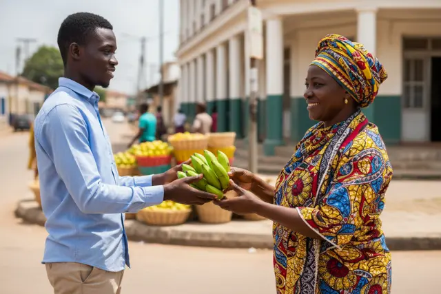
12. What are the best nearby beverage, snack, and meal options for locals staying in free viewing spots (including vendor availability along popular free zones) and any tips for staying hydrated in the heat?
Near Marina viewing spots, buy roasted plantain, fish skewers, zobo, sachet water; vendors line Marian Road and free zones; stay hydrated with plain water plus electrolyte sachets, shade often.
13. How do residents with mobility challenges access suitable free viewing areas, and which spots offer the best ground-level sightlines or gentle surfaces for wheelchairs or strollers?
Tinapa Free Zone has flat, ramped paths to Lakeview and Beach view areas, offering ground-level sightlines ideal for wheelchairs and strollers.
14. Are there any local traditions or unofficial tips (e.g., pre-parade ground preparation, morning assembly areas, or rumor of collapsible barriers) that a Calabar local should know to maximize free viewing opportunities without violating norms?
Arrive before dawn at Marian Road near the Adjudication Point to snag a view; use official zones, stay orderly, carry water, respect locals; beware unverified barrier rumors.
15. In the event of last-minute road changes or weather interruptions, which contingency free-viewing options around the route (e.g., alternate corners, pedestrian bridges, or side streets) do locals trust to still experience the Carnival parade without purchasing a ticket?
Free viewing spots include the Eleven Eleven Roundabout corners, pedestrian bridges over Marian Road, and sidestreets along Mary Slessor Avenue.